|
Size: 2164
Comment:
|
Size: 2155
Comment:
|
| Deletions are marked like this. | Additions are marked like this. |
| Line 29: | Line 29: |
| {{ attachment:LaunchLoop400.png }} | {{ attachment:in01.png }} |
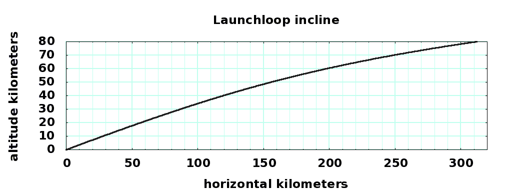
Inclines Sections
The inclines are the regions of the loop where the rotor rises from the surface to 80km launch altitude.
MORE LATER
parameter |
bottom value |
top value |
units |
horizontal distance |
0 |
311.9 |
kilometers |
vertical distance |
0 |
80 |
kilometers |
incline sheath mass |
10 |
10 |
kg/m |
cable angle |
38.85 |
- |
degrees |
cable offset |
20.0 |
- |
kilometers |
cable support length |
80.0 |
80 |
kilometers |
incline slope |
0.3640 |
0.1400 |
vert/horiz |
incline angle |
20.00 |
8.01 |
degrees |
deflection force |
205,016 |
82,093 |
kiloNewtons |
deflection force vertical |
201,902 |
81,893 |
kiloNewtons |
deflection force horizontal |
35,601 |
5,731 |
kiloNewtons |
rotor mass density |
2.9882 |
3.0000 |
kg/meter |
rotor velocity |
14,055 |
14,000 |
meter/sec |
gravity |
9.81 |
9.57 |
meter2/sec |
cable force ratio gz |
1.14 |
4.73 |
vert/horiz |
cable axial force |
- |
27,701 |
kiloNewtons/rotor |
station support force |
- |
54,792 |
kiloNewtons/rotor |
station + elevator mass |
- |
5726 |
metric tons/rotor |
main diagonal cable mass |
- |
2150 |
metric tons/rotor |
incline cable mass |
- |
1280 |
metric tons/rotor |

source. gnuplot control file You will need http://gnuplot.info to make the plot, though you can output the data to other plotting packages.
