Clouds
Clouds will interfere with critical distance measurements for the launch loop, especially on the inclines. The launch loop requires very accurate position measurement for aiming and stability. Laser interferometers in vacuum are good for distance measurement; along with telescopic angle measurement against the fixed stars, and differential GPS, we should be able to establish track position within a fraction of a millimeter.
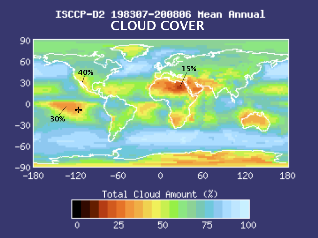
The inclines, often shrouded by clouds, will be more problematic. We may need to load those with evacuated tubes to run laser beams through. There is no place on earth with zero cloud cover throughout the year. Here is a plot of the average annual cloud cover: |
|
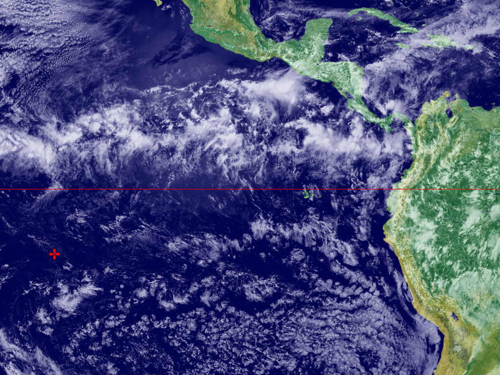
And here is a satellite picture of the clouds girding the equator in the Inter Tropical Convergence Zone (ITCZ): |
|
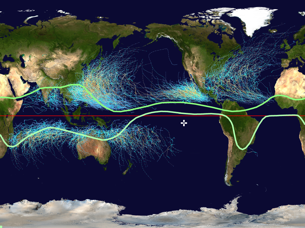
The ITCZ moves north during northern winter, and south during southern winter. The green bands show the "average extrema" of the ITCZ. Since there is often a squall line of thunderstorms at the ITCZ, where air lofts upwards at the Hadley cell boundary, we want to stay well clear of that. We also want to stay clear of hurricane and typhoons, whose tracks are shown on this picture: |
|
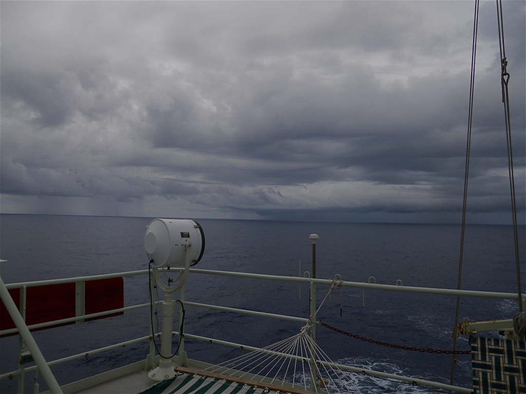
Keep in mind that the average changes over the year, and that a low, continuous blanket of clouds can persist over a large region for days. Here are the clouds at the equator in the Pacific, when the ITCZ drifts south during northern summer: |
|
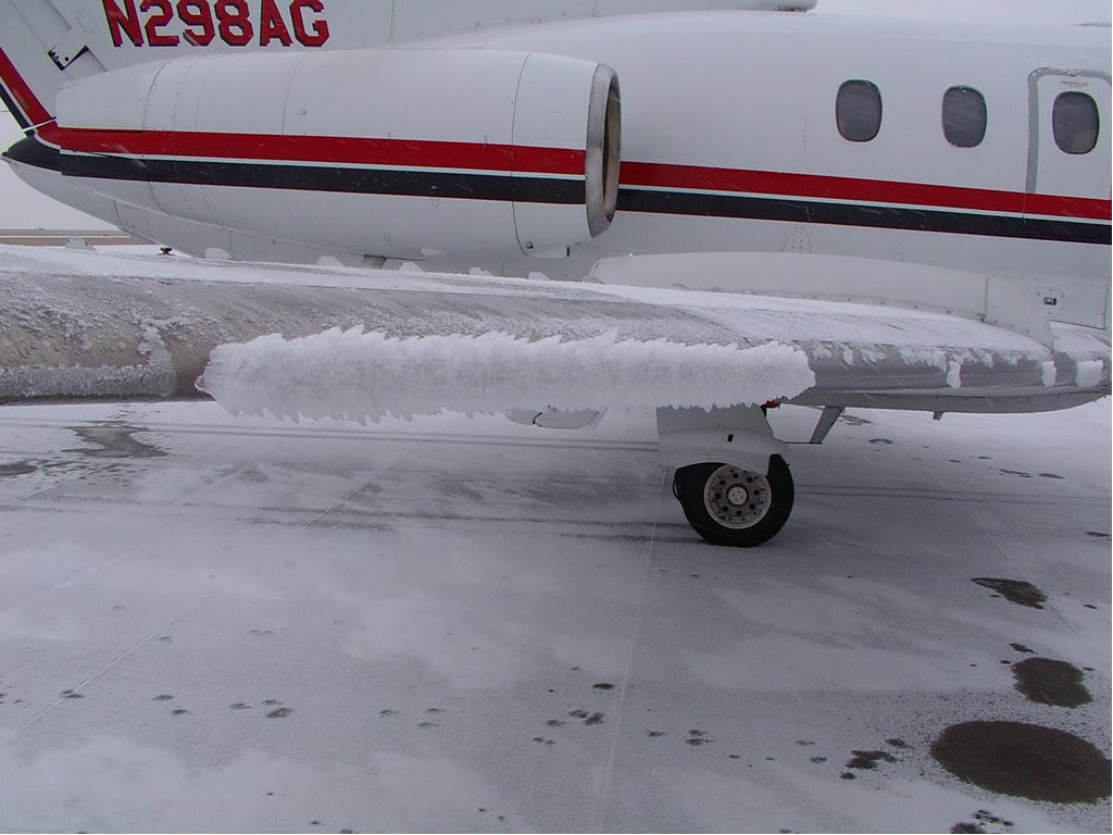
The incline track will be sometmes be shrouded in clouds for days. This will cause icing at some altitudes, similar to that on the leading edge of this airplane wing: |
|
MORE LATER

